nwSurfing.com 2.0
Waves
| Buoy |
Date |
Time |
Overall |
Dir |
Ground |
Dir |
Wind |
Dir |
| GHB |
03/01 |
10:56 |
4.3@6 |
291° |
2.3@11 |
WNW |
3.6@10 |
WNW |
| NEA |
03/01 |
10:40 |
4.3@5 |
263° |
3@10 |
W |
3.3@4 |
ESE |
| CPE |
03/01 |
10:40 |
3.9@6 |
303° |
3.6@11 |
WNW |
1.6@4 |
SSE |
| PA |
02/02 |
02:00 |
1@7 |
290° |
0.7@13 |
WNW |
0.7@9 |
WNW |
| CLA |
03/01 |
11:00 |
3.9@6 |
269° |
2.3@11 |
W |
3@10 |
W |
Wind/Air/Water
| Station |
Date |
Time |
WSPD |
WGST |
WDIR |
ATMP |
WTMP |
| WP Harbor |
03/01 |
10:36 |
- |
- |
-° |
-° |
-° |
| GHB |
03/01 |
10:56 |
- |
- |
-° |
-° |
49.6° |
| NB Harbor |
03/01 |
10:54 |
- |
- |
-° |
-° |
48.6° |
| NEA |
03/01 |
11:00 |
22.4 |
26.8 |
110° |
46.6° |
48.9° |
| CPE |
03/01 |
11:00 |
6.7 |
8.9 |
110° |
45.7° |
-° |
| LP Harbor |
03/01 |
10:36 |
5.8 |
8.1 |
180° |
46.4° |
49.3° |
| PA Harbor |
03/01 |
10:36 |
8.1 |
11.4 |
90° |
45° |
47.8° |
| PA |
02/02 |
02:00 |
- |
- |
-° |
46.9° |
48.2° |
Tides
Westport
NWS Forecast for: Coastal Waters From Point Grenville To Cape Shoalwater Out 10 Nm (PZZ156)
Issued by: National Weather Service Seattle, WA
Last Update: 215 AM PST Sun Mar 1 2026 |
|
Today: E wind 10 to 15 kt, easing to 5 to 10 kt late this morning, backing to N this afternoon. Seas 3 to 5 ft. Wave detail: NW 5 ft at 10 seconds.
Tonight: NE wind 5 to 10 kt, veering to E after midnight. Seas 3 to 4 ft. Wave detail: NW 4 ft at 9 seconds.
Mon: SE wind 5 to 10 kt, veering to S in the afternoon. Seas 3 to 4 ft. Wave detail: NW 3 ft at 9 seconds. A chance of rain.
Mon Night: S wind 10 to 15 kt. Seas 3 to 4 ft. Wave detail: S 4 ft at 8 seconds. Rain.
Tue: S wind 15 to 20 kt. Seas 5 to 7 ft. Wave detail: SW 7 ft at 7 seconds. Rain.
Tue Night: SW wind 15 to 20 kt. Seas 5 to 7 ft. Wave detail: SW 7 ft at 7 seconds and W 2 ft at 15 seconds. A chance of tstms. Showers in the evening, then rain after midnight.
Wed: W wind 15 to 20 kt. Seas 5 to 7 ft. Wave detail: SW 7 ft at 8 seconds and W 2 ft at 14 seconds. Rain.
Wed Night: W wind around 15 kt. Seas 6 to 8 ft, building to 8 to 10 ft after midnight. Wave detail: W 10 ft at 11 seconds. Rain.
Thu: SW wind 15 to 20 kt. Seas 8 to 10 ft. Wave detail: W 10 ft at 11 seconds. Rain.
Thu Night: W wind 10 to 15 kt. Seas 6 to 8 ft. Wave detail: W 8 ft at 11 seconds. Rain.
winds and seas higher in and near tstms.
|
Zone Forecast: Coastal Waters From Point Grenville To Cape Shoalwater Out 10 Nm (PZZ156)
|
West Ent Strait
NWS Forecast for: West Entrance U.S. Waters Strait Of Juan De Fuca (PZZ130)
Issued by: National Weather Service Seattle, WA
Last Update: 215 AM PST Sun Mar 1 2026 |
|
Today: E wind 5 to 10 kt. Seas around 3 ft. Wave detail: E 3 ft at 7 seconds.
Tonight: E wind around 5 kt. Seas around 3 ft in the evening, then around 2 ft or less. Wave detail: E 2 ft at 8 seconds.
Mon: SE wind around 5 kt, veering to S in the afternoon. Seas around 2 ft or less, then around 3 ft in the afternoon. Wave detail: W 2 ft at 9 seconds.
Mon Night: S wind 5 to 10 kt, becoming SE 10 to 15 kt after midnight. Seas around 3 ft. Wave detail: S 3 ft at 9 seconds. A chance of rain in the evening, then rain after midnight.
Tue: S wind 15 to 20 kt. Seas 3 to 5 ft. Wave detail: SE 4 ft at 6 seconds. Rain.
Tue Night: S wind 15 to 20 kt. Seas 3 to 5 ft. Wave detail: S 4 ft at 6 seconds and W 2 ft at 15 seconds. Rain.
Wed: S wind around 15 kt, becoming W 20 to 25 kt in the afternoon. Seas 3 to 5 ft. Wave detail: W 5 ft at 9 seconds and W 2 ft at 13 seconds. Rain.
Wed Night: W wind 15 to 20 kt. Seas 5 to 8 ft. Wave detail: W 8 ft at 11 seconds. Rain.
Thu: SW wind 15 to 20 kt. Seas 6 to 9 ft, subsiding to 5 to 7 ft in the afternoon. Wave detail: W 9 ft at 11 seconds. Rain.
Thu Night: W wind 15 to 20 kt. Seas 4 to 6 ft. Wave detail: W 6 ft at 11 seconds. Rain.
|
Zone Forecast: West Entrance U.S. Waters Strait Of Juan De Fuca (PZZ130)
|
Central Strait
NWS Forecast for: Central U.S. Waters Strait Of Juan De Fuca (PZZ131)
Issued by: National Weather Service Seattle, WA
Last Update: 215 AM PST Sun Mar 1 2026 |
|
Today: E wind 10 to 15 kt, easing to 5 to 10 kt late this morning and afternoon. Waves around 2 ft or less.
Tonight: E wind around 5 kt. Waves around 2 ft or less.
Mon: E wind around 5 kt. Waves around 2 ft or less.
Mon Night: SW wind around 5 kt. Waves around 2 ft or less. A chance of rain in the evening, then rain likely after midnight.
Tue: S wind 10 to 15 kt. Waves around 2 ft or less. Rain.
Tue Night: S wind 10 to 15 kt. Waves around 2 ft or less. Rain.
Wed: SW wind 10 to 15 kt, becoming W 20 to 25 kt in the afternoon. Waves around 2 ft or less, then 3 to 4 ft in the afternoon. Rain.
Wed Night: W wind 20 to 25 kt, easing to 15 to 20 kt after midnight. Waves 3 to 5 ft. Rain.
Thu: SW wind 15 to 20 kt, rising to 20 to 25 kt in the afternoon. Waves 3 to 5 ft. Rain.
Thu Night: SW wind 20 to 25 kt, becoming W 15 to 20 kt after midnight. Waves 3 to 5 ft. Rain likely.
|
Zone Forecast: Central U.S. Waters Strait Of Juan De Fuca (PZZ131)
|
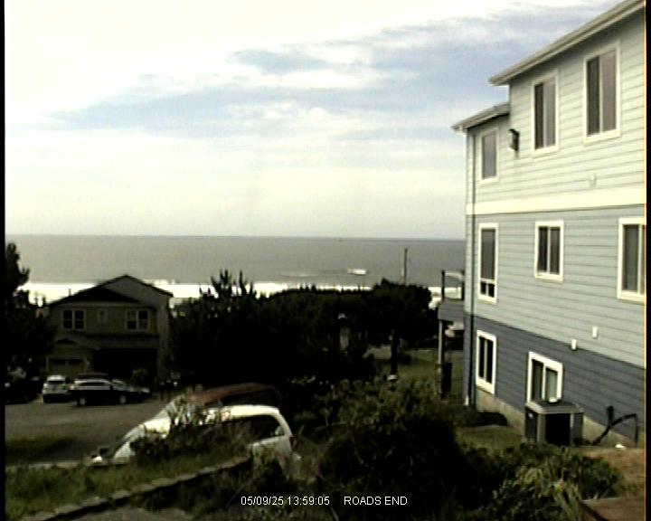
N. Oregon
NWS Forecast for: Coastal waters from Cape Shoalwater WA to Cape Falcon OR out 10 nm (PZZ251)
Issued by: National Weather Service Portland, OR
Last Update: 1232 AM PST Sun Mar 1 2026 |
|
Today: NE wind 5 to 10 kt, easing to around 5 kt this afternoon. Seas 4 to 5 ft. Wave detail: NE 2 ft at 4 seconds, SW 2 ft at 9 seconds and NW 4 ft at 10 seconds. A slight chance of rain late.
Tonight: E wind around 5 kt, veering to SE after midnight. Seas 3 to 4 ft. Wave detail: SW 2 ft at 9 seconds and NW 3 ft at 10 seconds. A chance of rain after midnight. Patchy dense fog after midnight.
Mon: S wind around 5 kt, rising to 5 to 10 kt in the afternoon. Seas around 3 ft. Wave detail: SW 2 ft at 8 seconds and NW 3 ft at 9 seconds. A chance of rain.
Mon Night: S wind 5 to 10 kt, rising to 10 to 15 kt after midnight. Seas 3 to 4 ft. Wave detail: S 3 ft at 5 seconds, NW 2 ft at 9 seconds and SW 2 ft at 14 seconds. Rain.
Tue: S wind 15 to 20 kt, rising to 20 to 25 kt in the afternoon. Seas 4 to 6 ft. Wave detail: S 6 ft at 7 seconds and NW 2 ft at 9 seconds. Rain.
Tue Night: S wind 20 to 25 kt, becoming SW 15 to 20 kt after midnight. Seas 5 to 7 ft. Wave detail: S 6 ft at 7 seconds and W 3 ft at 15 seconds. Rain.
Wed: W wind 15 to 20 kt. Seas 5 to 6 ft, building to 6 to 9 ft in the afternoon. Wave detail: W 5 ft at 6 seconds and W 8 ft at 13 seconds. Rain.
Wed Night: W wind 10 to 15 kt. Seas 9 to 11 ft. Wave detail: W 4 ft at 5 seconds and W 10 ft at 11 seconds. Rain.
Thu: SW wind 10 to 15 kt. Seas 8 to 11 ft. Wave detail: W 3 ft at 5 seconds and W 10 ft at 11 seconds. Rain.
Thu Night: W wind 10 to 15 kt. Seas 7 to 9 ft. Wave detail: SW 3 ft at 5 seconds and W 9 ft at 11 seconds. Rain.
|
Zone Forecast: Coastal waters from Cape Shoalwater WA to Cape Falcon OR out 10 nm (PZZ251)
|